Vector vs Raster Data in GIS 📍
Learn the differences between vector and raster data formats in GIS for accurate digital mapping and analysis.

Mr Cognito
40.2K views • Apr 6, 2024
About this video
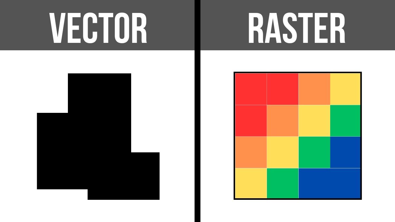
In the subject of Geographic Information Systems (GIS), the vector and raster formats are two ways of representing real-world phenomena on a digital map. The vector format relies on shapes with precise vertices, while the raster format consists of a grid made up of cells. Each has their advantages and disadvantages. There is a saying that goes, "Raster is vaster, but vector is corrector."
Videos:
Videvo.net
Pexels.com
Music:
Habanera by Bizet
GIS Software:
ArcGIS Pro
Videos:
Videvo.net
Pexels.com
Music:
Habanera by Bizet
GIS Software:
ArcGIS Pro
Tags and Topics
Browse our collection to discover more content in these categories.
Video Information
Views
40.2K
Likes
639
Duration
2:35
Published
Apr 6, 2024
User Reviews
4.7
(8) Related Trending Topics
LIVE TRENDSRelated trending topics. Click any trend to explore more videos.
Trending Now