U.S. Population Density & Westward Expansion (1790–2010)
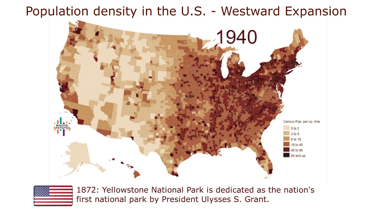
Animated map showing U.S. population growth and westward expansion from 1790 to 2010, based on county-level estimates. 📊

Racing Statistics
188.7K views • Jun 21, 2019
About this video
The animated map of population density, made using Jonathan Schroeder's county-level decadal estimates. Populations for intermediate years was interpolated by cubic splines to log-density; essentially, that means that it assumes a smooth change in the rate of growth for each county over time.
Westward Expansion summary: The story of the United States has always been one of westward expansion, beginning along the East Coast and continuing, often by leaps and bounds, until it reached the Pacific-what Theodore Roosevelt described as "the great leap Westward." The acquisition of Hawaii and Alaska, though not usually included in discussions of Americans expanding their nation westward, continued the practices established under the principle of Manifest Destiny.
____________________
Links:
Subscribe: https://bit.ly/2Zqk1DK
Facebook: https://www.facebook.com/RacingStats
Twitter: https://twitter.com/StatisticsRace
Credits: VividMaps
Data: Creatingdata.us
#USA #DataIsBeautiful #WestwardExpansion
Tags and Topics
Browse our collection to discover more content in these categories.
Video Information
Views
188.7K
Likes
2.4K
Duration
4:25
Published
Jun 21, 2019
User Reviews
4.6
(37) Related Trending Topics
LIVE TRENDSRelated trending topics. Click any trend to explore more videos.