South China Sea Length & Map | 5-Minute Overview 🌊
Learn about the South China Sea's size, boundaries, and key features in just 5 minutes with this quick guide.

5min Knowledge
5.9K views • Jul 14, 2023
About this video
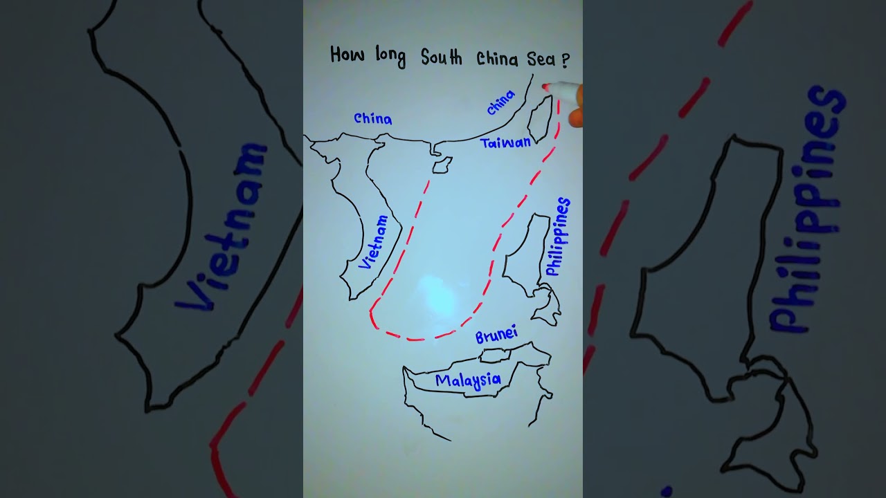
The South China Sea and the East China Sea together form the China Sea. The southern boundary of the South China Sea is a rise in the seabed between Sumatra and Borneo, and the northern boundary stretches from the northernmost point of Taiwan to the coast of Fujian province, China, in the Taiwan Strait.
The sea covers approximately 3,700,000 km² (1,350,000 sq mi), this is larger than the area of India. It is connected by the Taiwan Strait with the East China Sea and by the Luzon Strait with the Philippine Sea (both marginal seas of the Pacific Ocean).
#SouthChinaSea #SouthChinaSeaMap
#HowLongSouthChinaSea
#SouthChinaSeaRegions
#TotalAreaofSouthChinaSea
#SouthChinaSea_Map
#TheSouthChinaSea
#TheSouthChinaSeaMap
#5minknowledge
#5minuteKnowledge
#5MINKNOWLEDGE
#5MINUTEKNOWLEDGE
Please subscribe and like the videos
Channel link 👇
https://youtube.com/@5min_knowledge
Thanks for your support 😊
Tags and Topics
Browse our collection to discover more content in these categories.
Video Information
Views
5.9K
Likes
49
Duration
0:14
Published
Jul 14, 2023
User Reviews
4.2
(1) Related Trending Topics
LIVE TRENDSRelated trending topics. Click any trend to explore more videos.