Extracting Geotag Metadata from Photos with EXIFTool
A straightforward method to extract geotag information from a folder of drone images and generate a summary report for easy viewing.

Karen Joyce
110.2K views • Jun 3, 2019
About this video
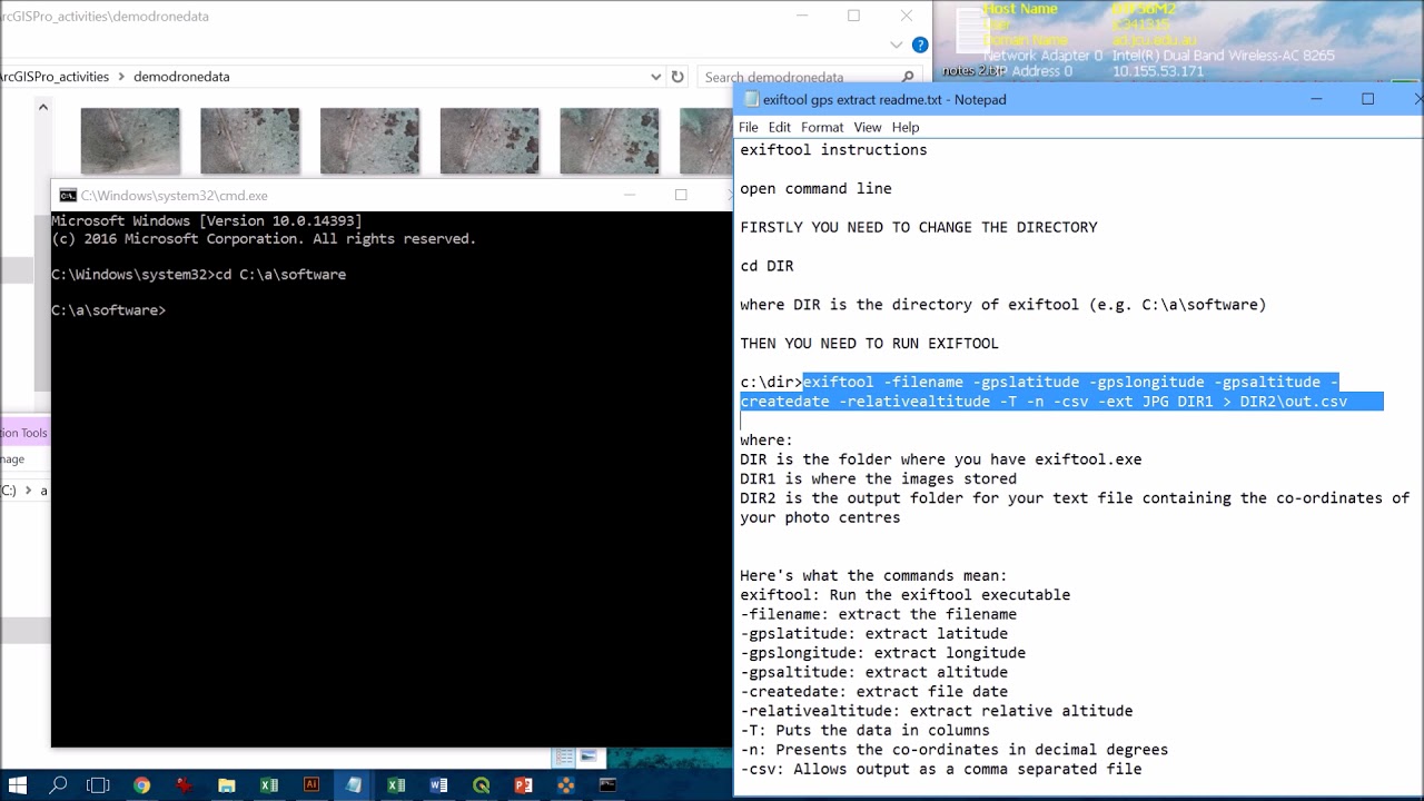
A quick and easy way to extract the geotag information from a folder of photos (in this case drone images), and output the data to a summary file for viewing or further analysis (see my videos about how to incorporate CSV files into either ArcGIS Pro or QGIS)
Tags and Topics
Browse our collection to discover more content in these categories.
Video Information
Views
110.2K
Likes
782
Duration
3:28
Published
Jun 3, 2019
User Reviews
4.3
(22) Related Trending Topics
LIVE TRENDSRelated trending topics. Click any trend to explore more videos.
No specific trending topics match this video yet.
Explore All Trends