Flood Risk Map Reveals Dams on Active Fault Line in Tasmania 🌊
Hydro Tasmania's new flood modeling highlights potential risks for two dams near Huonville, built on an active fault line. Learn more about the implications for safety and planning.
ABC NEWS (Australia)
1.6K views • Jul 13, 2024
About this video
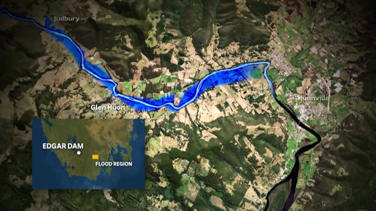
Two dams upstream from Huonville in southern Tasmania are built on an active fault line. Hydro Tasmania has had modelling done to map the potential flood area if the dams failed in an earthquake. The dams were classified as high-risk assets in 2016 sparking a debate about the community's right to know.
Video Information
Views
1.6K
Duration
2:29
Published
Jul 13, 2024
User Reviews
3.7
(1) Related Trending Topics
LIVE TRENDSRelated trending topics. Click any trend to explore more videos.
Trending Now